
Next-Generation Floating LiDAR System
Converting offshore measurements into bankable wind, load, and financing insights.
Designed for deep-water and shallow sites where fixed met masts are not feasible.
SYSTEM OVERVIEW
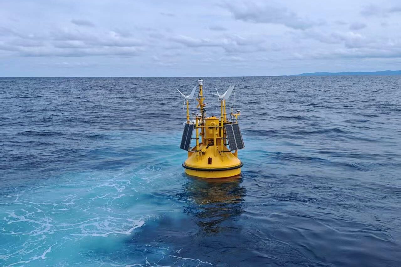
The Betz Floating LiDAR System is a next-generation offshore measurement platform engineered to deliver high-resolution wind and met-ocean data in deep-water environments.
Purpose-built for projects where traditional met masts are not viable, the system transforms environmental measurements into bankable datasets and engineering insights that support project financing and development.
KEY FEATURES
Flexible LiDAR Integration
- Compatible with ZX LiDAR and WindCube LiDAR systems
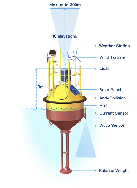
- Multi-height wind measurement up to 300m
- 10+ vertical measurement points
Fully Integrated Met-Ocean Sensors
- Wave sensors
- Current sensors
- Weather station
- GNSS positioning
IoT-Based Data Transfer
- Real-time data transmission
- Remote monitoring capabilities
- Cloud-connected architecture
Advanced Control System
- Modern dynamic control unit
- Stabilized measurement platform
- Autonomous operation offshore
Scalable Power System
- Solar-powered platform
- Supports additional payloads
- Designed for extended deployments
High Availability
- System availability >98%
- Built for harsh offshore conditions
- Reliable long-term campaigns
Certified Measurement Accuracy
- Reliable Turbulence Intensity (TI) measurements (corrected)
- Stage 3 certification compliant
Why it matters?
- Bankable AEP
- Turbine load design
- Mooring and platform fatigue
- Insurance and financing acceptance